
Hobart weather at a glance
Hobart sits in the southern hemisphere, so the seasons are reversed. Summer runs from December to February, autumn from March to May, winter from June to August and spring from September to November. The city is warm rather than hot in summer and cool rather than freezing in winter.
The numbers below come from the Bureau of Meteorology station Hobart (Ellerslie Road), at 51 m above sea level. They are long-term monthly averages from records that start in 1882, with the table published on 15 October 2026. Highs and lows are the averages of the daily maximum and minimum, not record values. Rainfall is the average monthly total, not the number of rainy days.
Hobart climate by month
Average daily high and low in °C and average monthly rainfall in mm.
| Month | Season | High °C | Low °C | Rain mm |
|---|---|---|---|---|
| January | Summer | 21.8 | 12.1 | 46.3 |
| February | Summer | 21.8 | 12.1 | 38.6 |
| March | Autumn | 20.3 | 11.0 | 44.1 |
| April | Autumn | 17.5 | 9.0 | 49.1 |
| May | Autumn | 14.6 | 7.0 | 47.6 |
| June | Winter | 12.1 | 5.2 | 53.6 |
| July | Winter | 11.9 | 4.7 | 51.9 |
| August | Winter | 13.2 | 5.3 | 53.8 |
| September | Spring | 15.2 | 6.5 | 52.8 |
| October | Spring | 17.0 | 7.8 | 62.0 |
| November | Spring | 18.8 | 9.4 | 54.0 |
| December | Summer | 20.4 | 10.9 | 56.6 |
The monthly figures add up to about 610 mm of rain a year. No month is dry, and the difference between the driest month (February, 38.6 mm) and the wettest (October, 62.0 mm) is modest. Expect some rain whenever you come and plan an indoor option for each day.
Tours and day trips from Hobart
Boat trips, wildlife visits and day trips from the city, with current prices and availability.
What each season is like
Ranges are the lowest and highest monthly averages within each season.
Summer, December to February
Highs average 20.4–21.8 °C and lows 10.9–12.1 °C. This is the warmest part of the year and the driest month, February, falls here. MONA announces a different ferry timetable from 3 December 2026, with a peak period to 29 March 2027, and the TMAG museum opens daily from 26 December to 31 March.
Autumn, March to May
March is still mild at 20.3 °C, but the highs fall to 14.6 °C by May. Lows drop from 11.0 °C to 7.0 °C. Snow and ice restrictions on the mountain road become more likely from April.
Winter, June to August
Highs average 11.9–13.2 °C and lows 4.7–5.3 °C. July is the coldest month. Rain is steady at 51.9–53.8 mm a month. Pack warm layers and waterproofs, and check road conditions before you drive up kunanyi/Mount Wellington.
Spring, September to November
Highs climb from 15.2 °C to 18.8 °C and lows from 6.5 °C to 9.4 °C. October is the wettest month of the year on average, with 62.0 mm. Snow and ice restrictions on the mountain road can still apply in September.

The best time to visit depends on your plans
The averages show that summer is warmer and winter is cooler. They do not name one best month, and they promise nothing for a given day. Use them to match the season to what you want to do.
If you want the mildest temperatures for walking, ferry rides and day trips, the summer months and early autumn have the highest highs. If you plan to go up the mountain, the road can be restricted by snow or ice at any time of year, most often from April to September. In winter, bring layers for every outdoor stop.
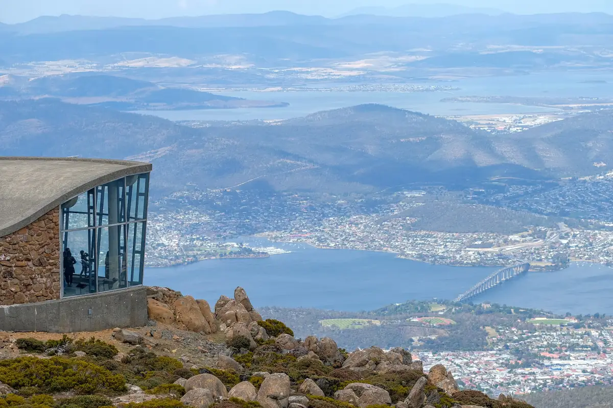
The city values do not describe the summit. kunanyi/Mount Wellington reaches 1,271 m, and conditions there can differ a lot from the waterfront. Bring warm and waterproof clothing even on a clear day in town.
Weather risks to plan around
Three things that can change a day, whatever the season.
Snow and ice on the mountain road
The Pinnacle Road from Fern Tree to the summit is paved, narrow and winding. The park authority says snow and ice restrictions are possible all year, especially from April to September. There is no guaranteed winter opening. Check the current road status before you leave.
Fire danger
Wellington Park closes when the fire danger rating is Extreme or Catastrophic. Follow all instructions from the park authority and check the rating on hot, dry and windy days in summer.
Storm and wind
In a storm or strong wind, paths in Mount Field National Park, including the one to Russell Falls, can close because of falling branches and trees. Keep a flexible plan for outdoor days.
The kunanyi/Mount Wellington guide covers the summit road, the shuttle and the walks in detail.
Plan the rest of your trip
Once you know the season, choose a base and a way in.


Hobart weather: frequently asked questions
What is the warmest month in Hobart?
January and February, with an average daily high of 21.8 °C and a low of 12.1 °C. Remember that these are averages. Individual days can be warmer or cooler.
What is the coldest month in Hobart?
July, with an average high of 11.9 °C and an average low of 4.7 °C. June and August are close behind.
Which month has the most rain?
October averages 62.0 mm, the highest monthly total. February averages 38.6 mm, the lowest. Every month has noticeable rain, so pack a waterproof layer all year.
When is summer in Hobart?
December to February, because Tasmania is in the southern hemisphere. Winter is June to August, spring is September to November and autumn is March to May.
Will it snow in the city?
The averages above are for a station at 51 m and show lows of about 5 °C in winter. They do not predict snow on a given day. Snow and ice are more of an issue on the mountain, where the summit road can be restricted at any time of year.
Can I use these numbers for the summit?
No. They describe the city station. The summit of kunanyi/Mount Wellington is at 1,271 m, so check the current weather and road status before you go and bring warm, waterproof clothing.